


| Walks Programme 2011/12 |
|
Unless it's a coach trip we meet at the start of the walk for a 10am start.
When we use a coach (approx Ł5) it starts from Fujitsu Services
(MAN33/4/5) just off Oldham Road - see map
for directions. |
| 11th Sep 2011 |
Walkerwood - Tintwistle - Walkerwood "A" and "B" Walks |
Meet at the car park near the reservoir for a 10.00 am start. [Grid Ref SJ 98600 99163] -> Google Map Latitude: N53.489176, Longitude: W2.022568 |
| 25th Sep 2011 | Ashford – Monsal Head – Sheldon – Ashford |
Meet at the post office in Ashford for a 10.00 am start. [Grid Ref SK 19701 69738] -> Google Map Latitude: N53.224352, Longitude: W1.706368 |
| 1st & 2nd Oct 2011 | Mini Hostel weekend at Slaidburn |
|
| 23rd Oct 2011 | Marsden Circular |
Meet at the railway station for a 10.00 am start. [Grid Ref SE 04746 11843] -> Google Map Latitude: N53.603130, Longitude: W1.929752 |
| 20th Nov 2011 | Werneth Low - Ethrow – Peak Forest Canal | Meet at the church at the bottom of Joel Lane Hyde for a 10.00 am start.
[Grid Ref SJ 95369 93338] -> Google Map Latitude: N53.436799, Longitude: W2.071176 |
| 4th Dec 2011 |
Christmas Dinner | |
| 8th Jan 2012 | Styal – Airport – Mobberley – Styal |
Meet at the car park just after the Ship Inn, Styal, for a 10.00 am start. |
| 29th Jan 2012 | Grouse Inn - Lantern Pike – Rowarth – Cown Edge – Grouse Inn | Meet at car park / layby just past the Grouse Inn (SK13 6JY) on the Hayfield to Glossop Rd (A624) at 9.45 for a 10.00 am start. [Grid Ref SK 03348 90861] -> Google Map Latitude: N53.41455, Longitude: W1.95109 |
| 12th Feb 2012 | Chadkirk – Werneth Low - Chadkirk |
Meet at the car park on Vale Road
for a 10.00 am start. [Grid Ref SJ93729 89718] -> Google Map Latitude: N53.404243, Longitude: W2.095789 |
| 4th Mar 2012 |
Disley – Kettleshulme – Disley | Meet at Disley station for a 10.00 am start. [Grid Ref SJ 97385 84632] -> Google Map Latitude: N53.358561, Longitude: W2.040759 |
| 25th Mar 2012 |
Derwent Edge - Strines (where the Dambusters practiced) |
Meet at the car park on the Sheffield Road just after
Ladybower reservoir for a 10.00 am start. [Grid Ref SK 21716 87413] -> Google Map Latitude: N53.383122, Longitude: W1.674990 |
| 15th Apr 2012 | Barley - Pendle Hill – Barley “A” and “B” walks |
Meet at Barley car park for a 10.00 am start. [Grid Ref SD 82321 40317] -> Google Map Latitude: N53.858776, Longitude: W2.270276 |
| 29th Apr 2012 | Hathersage Circular |
Meet in Hathersage for a 10.00 am start. [Grid Ref SK 23171 81548] -> Google Map Latitude: N53.330343, Longitude: W1.653543 |
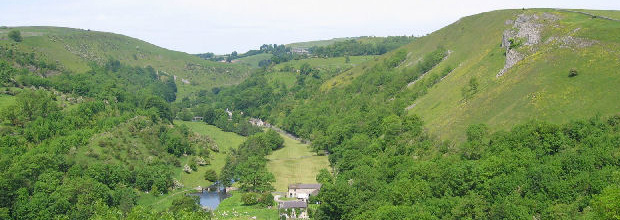
| 13th May 2012 | Youlgreave – Winster – Youlgreave “A” and “B” walks |
Meet at the car park at the end of the village for a 10.00 am start. [Grid Ref SK 20501 64052] -> Google Map Latitude: N53.173187, Longitude: W1.694754 |
| 20th May 2012 |
Black Sail Youth Hostel Mini weekend NB. 1 place left |
Meet at Ennerdale Bridge for a 10.30 am start. Maps will be issued on the day. [Grid Ref NY 07050 16052] -> Google Map Latitude: 54.531184, Longitude: W3.437878 |
| 3rd Jun 2012 | Longnor – Hartington – Longnor | Meet in Longnor for a 10.00 am start. [Grid Ref SK 08873 64921] -> Google Map Latitude: N53.181319, Longitude: W1.868693 |